Discovering the Hidden Wonders and Practical Tips of Tekes, Xinjiang
Discovering the Hidden Beauty and Practical Tips of Tekes, Xinjiang
First up, here’s a snapshot showing just how much fun there is to be had:
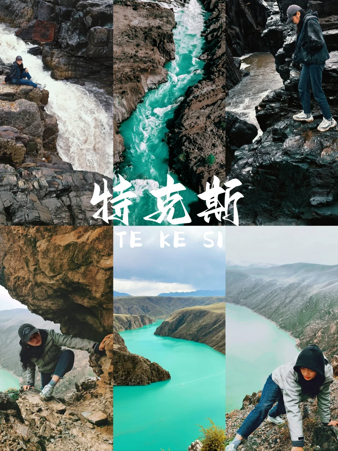
I’m the kind of person who loves to skip the tourist hotspots and seeks out the little nooks and crannies instead. This time, on my trip through the Ili Grand Loop, I used Tekes as a resting point and ended up discovering four delightful surprises in just two days: a free hiking trail at Crocodile Bay, a mini Hukou Waterfall, a local diner where meals are just 20 yuan each, and a perfect spot to launch my drone for panoramic views of Bagua City. Here’s all the good stuff I found after trudging through the mud—just follow my lead!
Why Choose Tekes for a “Reverse Layover”?
- Bagua City is a transport hub, so it’s a great place to stay overnight when visiting Karajun, Qiongkushitai, or Koksu.
- The official Koksu route has a 155 yuan entry fee and long lines for the shuttle, but right next to it, there’s a shepherd's trail that leads to the same lake—free and way less crowded!
Exploring Crocodile Bay
| Item | Info |
|---|---|
| Navigation Endpoint | Tekes Yanyu Homestay Manor (searchable on GaoDe/Baidu) |
| Sign at Village Entrance | Look for the sign reading “Aketireke Village” and turn in when you see a row of poplar trees. |
| Hiking Distance | 2.4 km one way, about 40 minutes downhill to the lake. |
| Trail Condition | Gravel path; anti-slip shoes work fine, cars can park halfway up on the shoulder. |
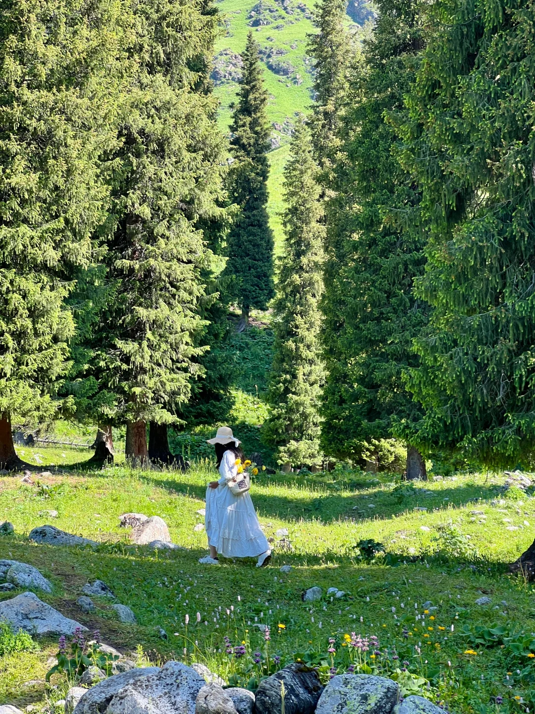
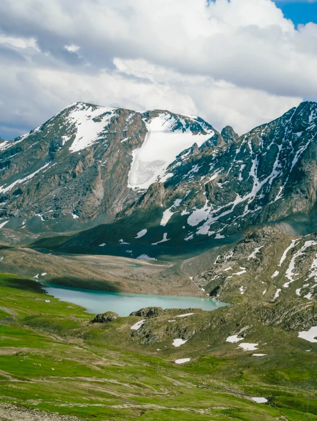
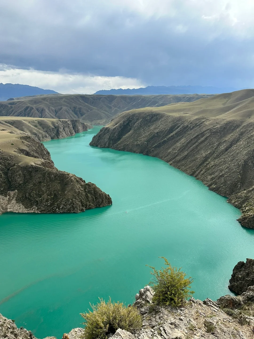
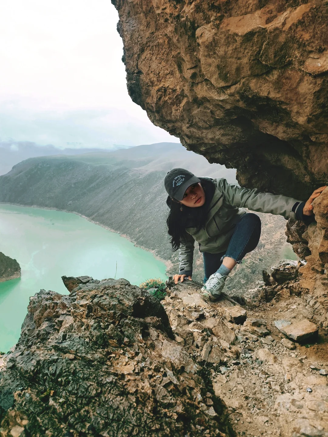
Following the local shepherd's directions, I parked under some pine trees and walked down a little dirt path that smelled of sheep dung, surrounded by fallen trees and wild mint. When I reached the valley, suddenly, I spotted that emerald green nestled within the reddish-brown rock layers. No one was collecting tickets, just a couple of horses grazing.
Photo spots:
- Big stone by the water edge—perfect for reflection shots.
- Climb up the low ridge on the opposite bank for an aerial view of the crocodile-shaped bend.
Drone altitude restriction is 500 meters, remember to file a report beforehand—more detailed tips coming up.
Hukou Waterfall Route Introduction
Head towards Qiongkushitai from the county town, and along the 162 provincial road, you’ll find a branch of the Tekes River, known locally as the Koksu section. After rain, water levels rise drastically, creating several tiers of small waterfalls. The most noticeable section has water cascading over rocky debris under the bridge, it’s like a mini Hukou, roaring with excitement.
| Item | Info |
|---|---|
| Navigation | Flower Sea Karajun |
| Directions | Drive 300 meters before the scenic area entrance, turn left and go downhill, cross an old cement bridge to arrive. |
| Waterfall Location | 50 meters downstream from the bridge; hike 200 meters upstream for second and third tiers. |
| Water Volume | Most fierce within 2 hours post-rain, on sunny days, it’s just a flowing green ribbon. |
I happened to catch a light rain the night before, and the water sound shook the bridge. I had to strap my camera to the railing to take long exposures, creating a contrast between the earthy yellow waves and the green backdrop.
Food: Old Brand BBQ Spot
- Location: On the outskirts of Bagua City, in Tuanjie Alley—look for a red lantern under a metal shed.
- Must-Try: Skewered meat (2 yuan each), red willow lamb (6 yuan each), self-brewed kvass for 10 yuan a bucket.
- Timing: Most locals show up after 7 PM; quick table turnover and the grill never stops cooking.
- Average Cost: 20 yuan will fill you up; I managed to polish off 20 skewers plus a bowl of pilaf!
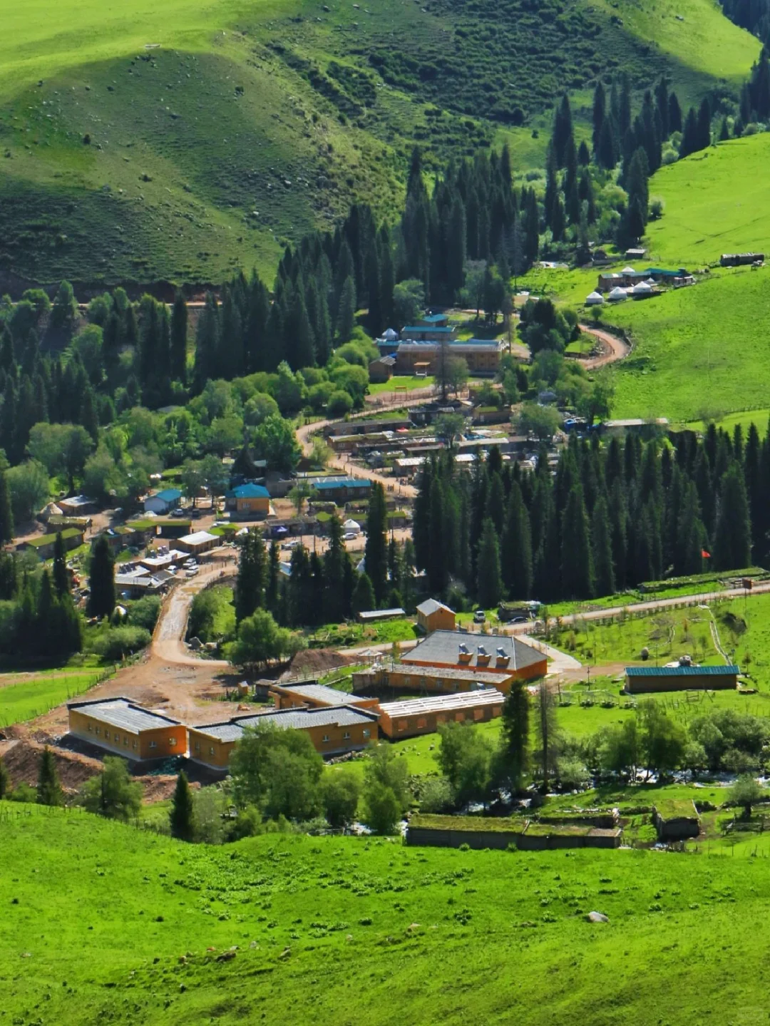
Stay: Tekes Anyu Homestay
- Room Types: Standard room for 240 yuan, a charming white house with blue roofs in the garden—great for photos!
- Amenities: Pressure-free mattresses, bathtubs, and a projector—very friendly for female guests.
- Bonus: The rooftop terrace offers direct views of the Bagua City nightscape, saving you a trip to the lookout at night.
Drone Flight Registration Tips
| Step | Details |
|---|---|
| Location | In front of the Tekes Taiji Police Service Station |
| Materials Needed | ID + drone serial number |
| Duration | 5 minutes to fill out a form, a friendly officer will stamp it. |
| Timeframe | Flights can happen any time except from 2 AM to 8 AM |
| Altitude Limit | Officially 120 meters, but test showed 500 meters isn't strictly enforced. |
| Recommended Launch Spot | An open area south of the fire station; fly south for three minutes to get both Bagua City and snow-capped mountains in your frame. |
One-Day Reverse Itinerary (Copy this!)
| Time | Itinerary | Tips |
|---|---|---|
| 07:30-08:00 | Homestay Breakfast | Just bring bread! |
| 08:00-08:30 | Drive to Yanyu Homestay Manor | Set your navigation right. |
| 08:30-11:30 | Hike & shoot at Crocodile Bay | Bring 1.5L of water and sunscreen. |
| 11:30-12:00 | Stop by the supermarket on the way back | Stock up on fruits. |
| 12:00-14:00 | Eat at Old Brand BBQ Spot | Arrive early to avoid waiting. |
| 14:00-15:00 | Back to homestay for a nap | Take a warm shower to refresh. |
| 15:30-17:00 | Head to Hukou Waterfall | Water volume determines how long you stay. |
| 17:00-18:30 | Return to Bagua City for drone photography | Swing by the police station for the stamp. |
| 19:00-22:30 | Rooftop for blue hour shots + second round of red willow BBQ | The homestay rooftop has nice lighting for photos. |
This trip was a pure independent journey, costing less than 200 yuan per person (excluding gas money), avoiding the peak tourist crowds and almost having all the spots to myself. I’ve marked all the map points; just follow the order, and you can't go wrong.
Here are a couple more spontaneous shots from the scene:
Recommended in the Same City